Latest version: 5.0.1 build 1210. December 10, 2024.
The Geo Export module is intended for creating track files in various popular formats such as KML, GPX, Google Earth, and others. The module receives coordinates and additional data and then saves them in a file in real-time.
Since coordinates are a mandatory requirement for creating a file, the module is mainly used with our Advanced NMEA Data Logger and GPS Tracker Data Logger programs, which are used in work related to geolocation. The module can also be configured to work with other data sources in other data loggers that receive coordinates. For example, Advanced Serial Data Logger can add a placemark from a GPS receiver connected to COM1 to data that is received via COM2.
The module can simultaneously create files in several formats and generate a new file according to the schedule.
List of supported formats:
- Google Earth KML (waypoints)
- Google Earth KML (tracks)
- Google Earth KML (polyline)
- GeoJSON
- GPX
- OpenGIS GML
How to enable this plugin
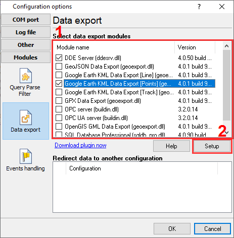
The figure below shows how to select the plugin on the "Modules" page.

Fig.1. Selecting the plugin.
How to configure the plugin
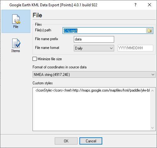
The figure below shows how to configure the plugin. Please, look at the documentation for the full description of all settings.

Fig.2. Configuring the plugin.
Read more about other plugins:
Index | Deadband | Expressions | Aggregator | Digital inputs filter | Script execute | Events generator and simple filter | Redirect data | Data timeout | SQL Database Pro | DDE Server | Direct Excel Connection | Excel Export Professional | Local database | ODBC Database | Send Keystrokes | Printer out | Internet Sharing | Event notification | Index